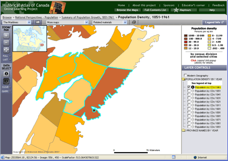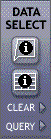
The Data/Select tools are activated to select features on the map and display data for them.
Click to activate the Identify tool, then click on a feature on the map and a window will pop up with information about it.
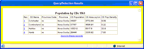
Click to activate the Table tool. Then, click or drag a rectangle on an area of the map to select features, and a data table will pop up.
Click to unselect currently selected features.
Click to create a selection query; see next Help page for details.