|
|
||||||
 |
|
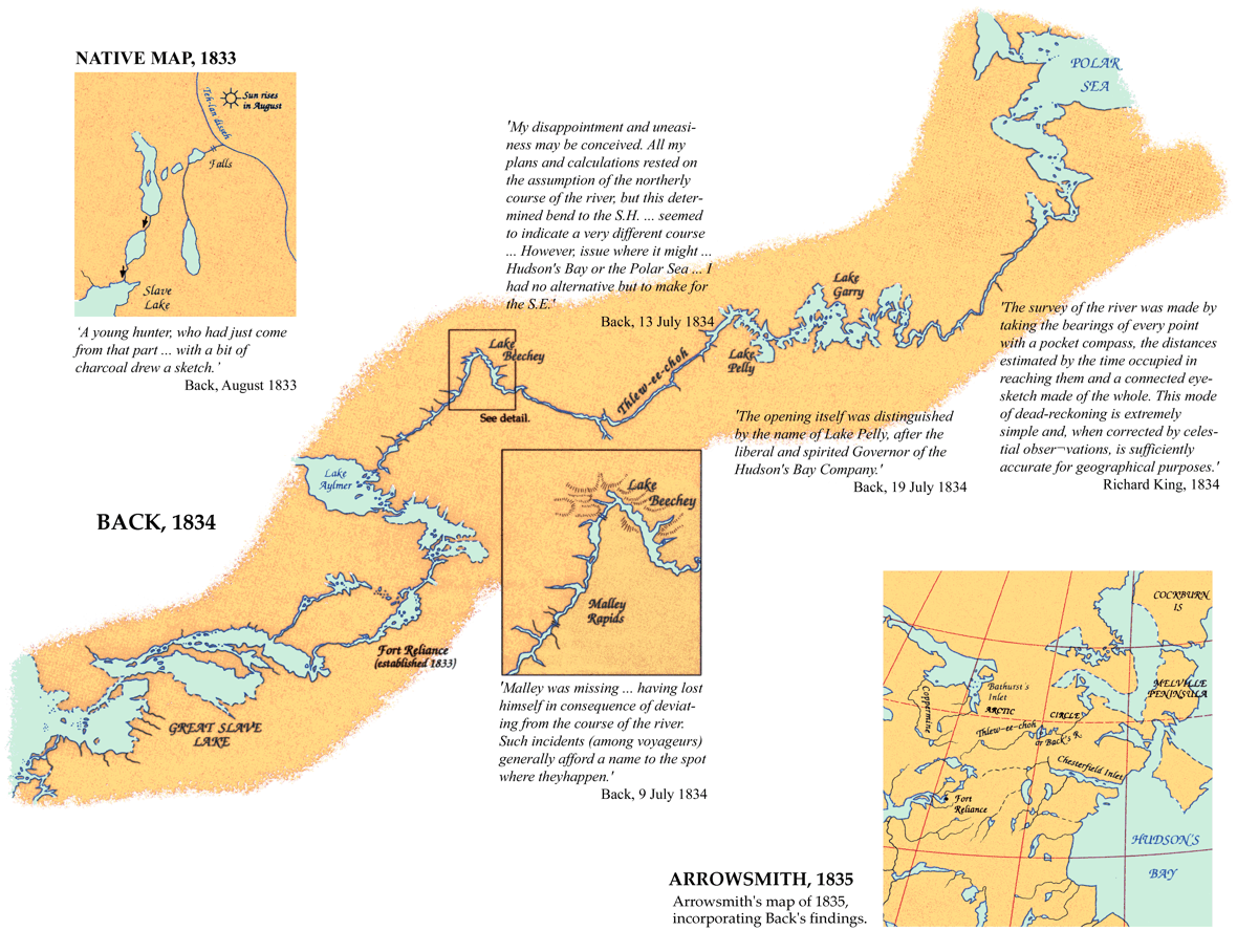
Back map, 1833-34 |
|
In 1833 Captain George Back of the Royal Navy and surgeon-naturalist Richard King sought a land route across the Arctic Barren Lands in an attempt to determine the fate of the missing 1829 John Ross expedition and to pursue the survey of the Arctic coast in the quest for a Northwest Passage. Back's exploration of 1833-4 not only produced new geographical knowledge that made possible improvements in Arrowsmith's map of 1835, but also contributed scientifically valuable observations of wildlife, magnetic effects, and the aurora borealis. |
|
Original map: Map of the Discoveries aand Route af the Arctic Land Expedition in the years 1833 & 1834. Surveyed and Drawn by Captain Back R.N. Great Slave Lake to Adelaide Peninsula
Source: ĀLibrary and Archives Canada/NMC 6145 |
|