Maptour Page 2
Maptour: The Boundaries of Canada, 1670-2001
Contending for Space


Click to enlarge

Map: Boundary Changes, 1670-2001

Try This:

  • Open the interactive map "Boundary Changes, 1670-2001"

Notice ...

  • The Hudson Bay drainage basin defines Canadian political geography in 1670.
  • In 1670, England and France were major colonial claimants in North America.

Try This:

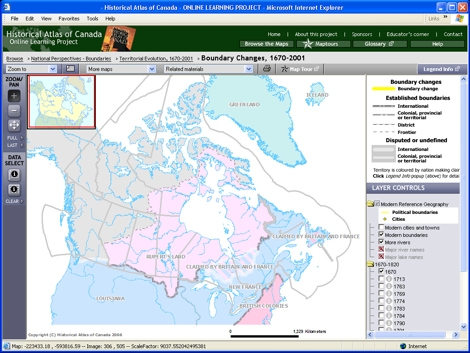
  • Under LAYER CONTROLS, turn on the checkbox for "Modern Reference Geography".
  • On the map, territory is coloured by the nation making claims. Click on the "Legend Info" button above the Legend to pop up a window showing detailed legend information. Scroll down to the section on "National affiliation" to find the colours which appear on the map.

Notice ...

  • Denmark claimed territory in America (Greenland) comparable in size to Canada's three prairie provinces.

Consider!

  • Canada's history of internal land claims and international territorial tensions has been in progress for centuries.