|
|
||||||
 |
|
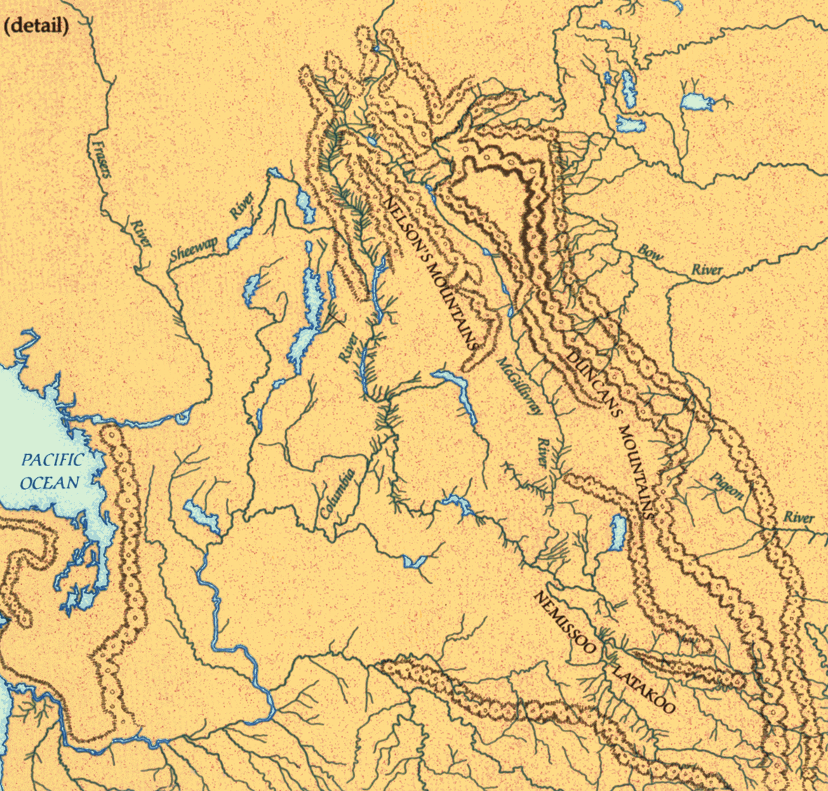
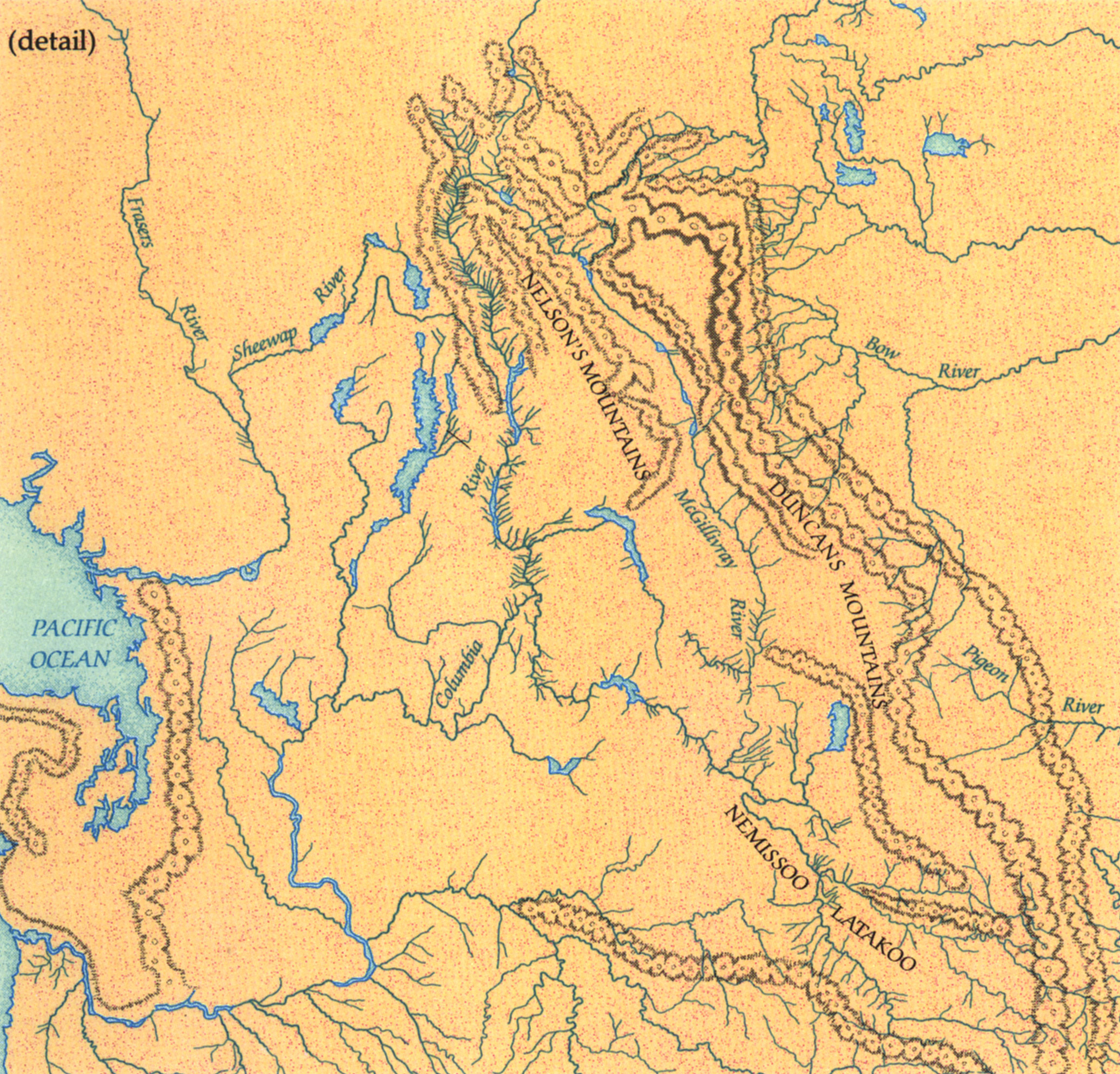
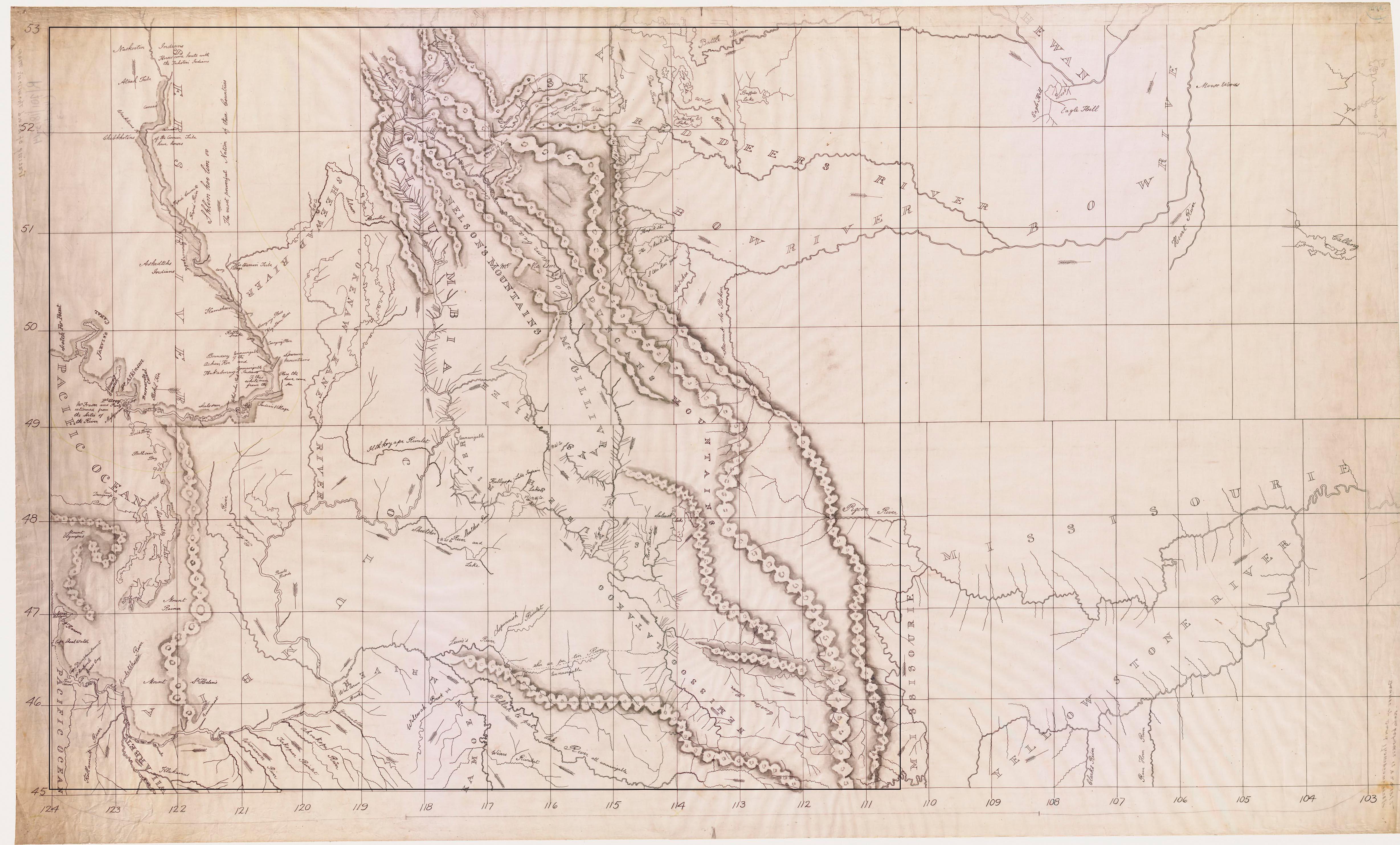
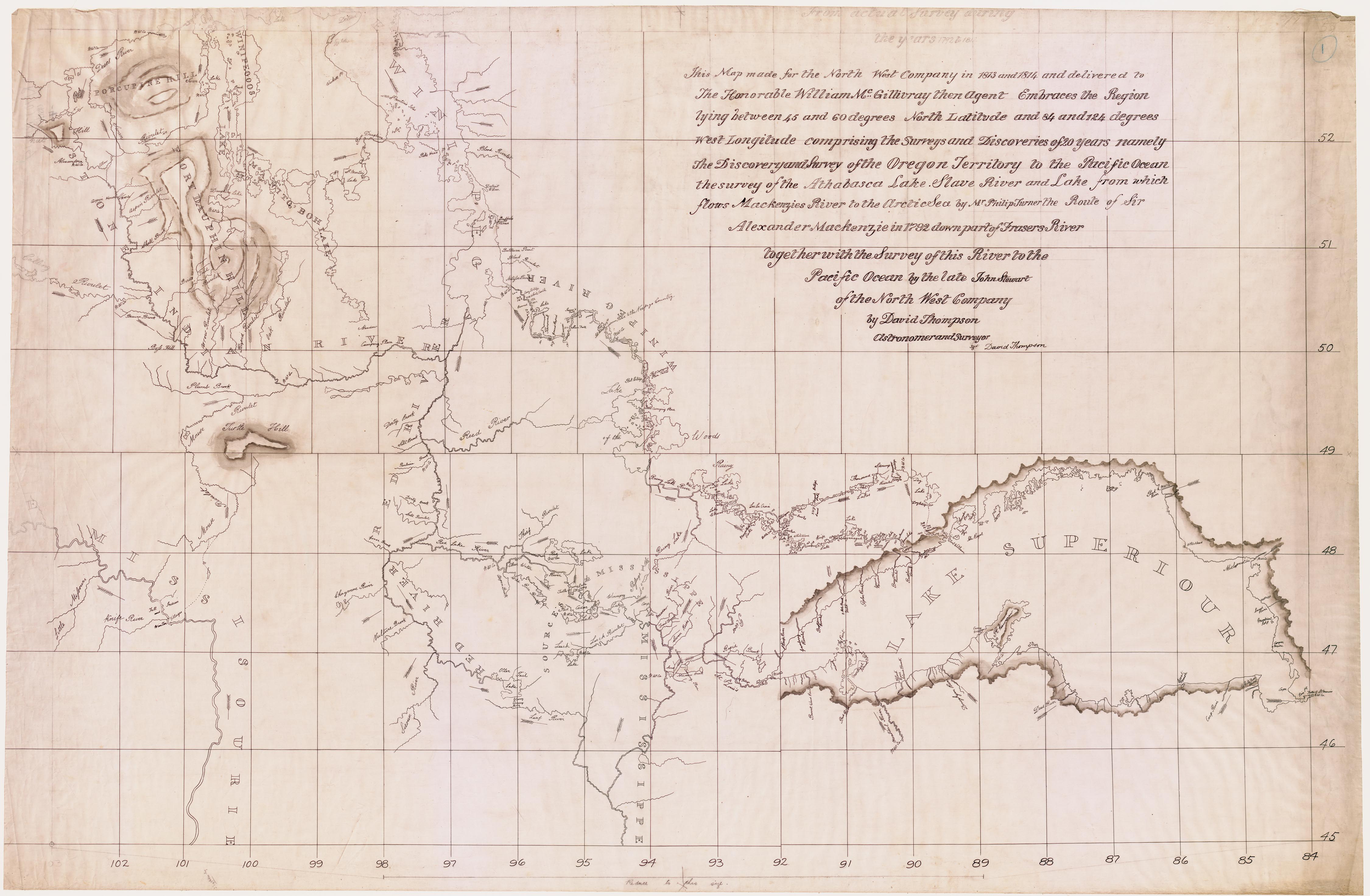
Thompson map, 1814 |
|
Taught by Philip Turner, David Thompson surveyed for the HBC in northern Saskatchewan and Manitoba before he transferred to the Northwest Company in 1797. Over the next 15 years he surveyed from Lake Superior to the Pacific and, during several years in the Cordillera, unravelled the complex drainage basin of the Columbia River. The map above is a redrafted portion of Thompson's monumental map of northwestern North America. |
|
Maps in High Resolution
Thompson Redrawn Thompson Original Part 1 Thompson Original Part 2 Thompson Original Part 3 Thompson Original Part 4 |
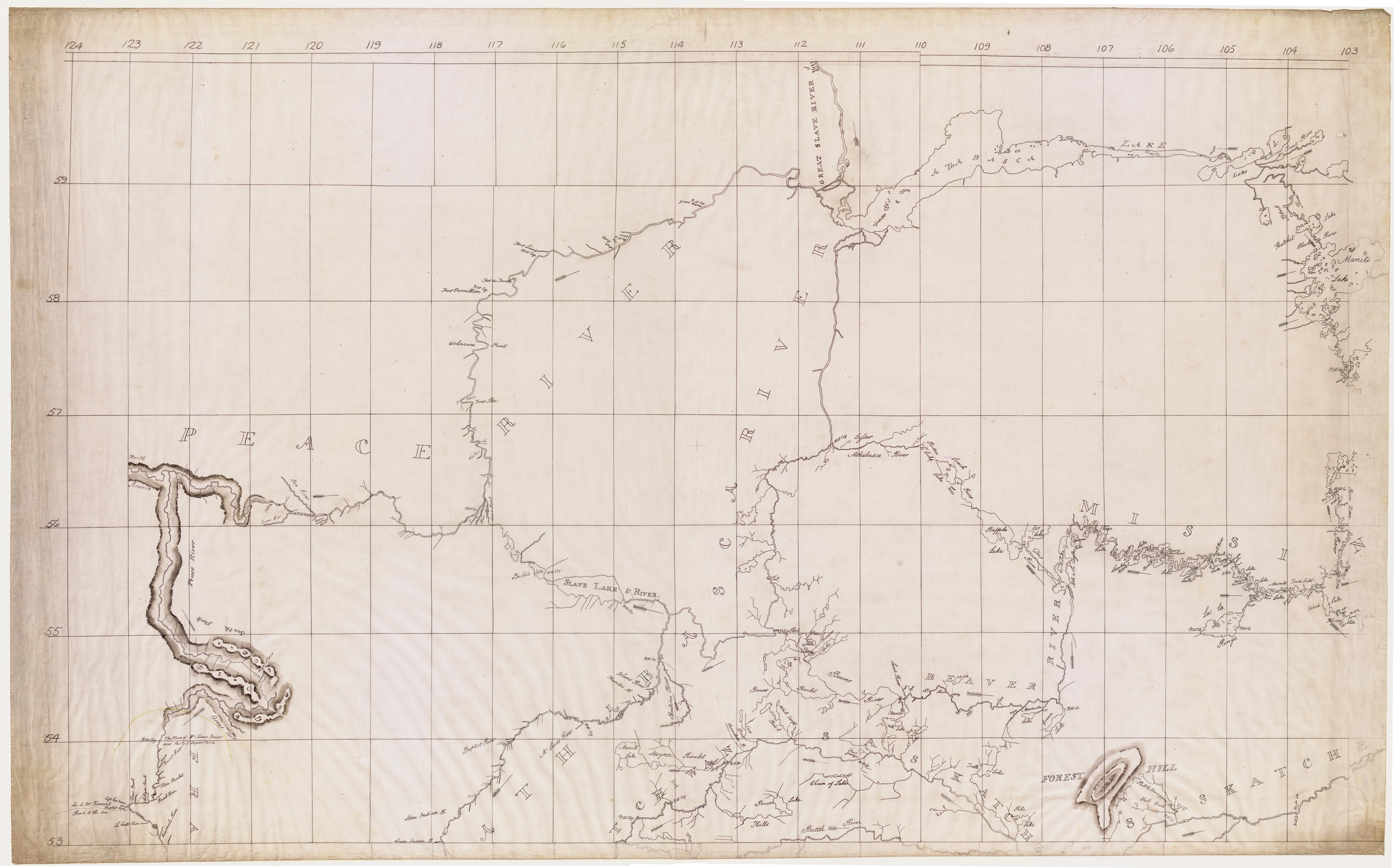
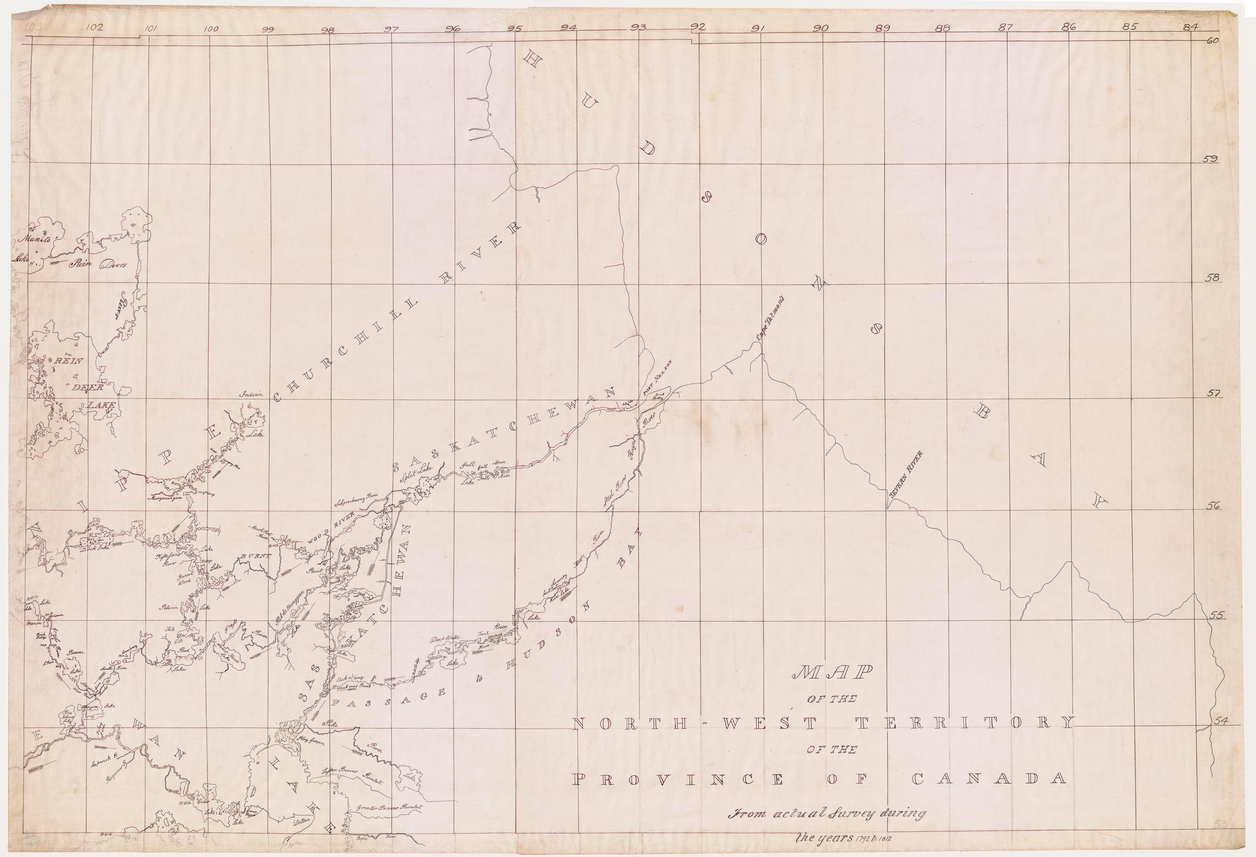
Original map: Map of the North-West Territory of the Province of Canada from actual survey during the years 1792 to 1812...1813 and 1814... by David Thompson, Astronomical Surveyor
Source: ĀLibrary and Archives Canada / NMC R/701/1813-1814 |