|
|
||||||
Area units: Data units: |
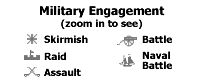 |
Military Engagement |
 |
Troop Movement |
 |
Settled area shown represents the "ecumene" or area of generalized continuous settlement as it existed between 1812 and 1814. Unsettled areas are show as British, or American. |
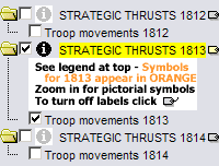 |
These layers each contain the locations and types of military engagements, as well as the troop movements which took place in 1812, 1813 and 1814 respectively. The symbols for each year are coloured differently (black for 1812, orange for 1813, and purple for 1814). The troop movements can be turned off by clicking in the check box beside this layer name. The labels for the individual military engagements can be turned on and off by clicking on the |
 |
The active layers in this map are in the three Strategic Thrusts folders (1812, 1813 and 1814). Use the tools below to get data about the military engagements shown in these folders. |
Identify: Click on the Identify tool, then click on the map on one of the military engagement symbols, to pop up a box describing the location of the engagement, and the date on which it took place. |
|
Table: Click on the Table tool, then click or drag a rectangle on the map across one of the military engagement symbols, to pop up a box describing the location of the engagement, and the date on which it took place. See Table Fields below. |
| Location and Date | Location of the military engagement, and the date on which it took place. |
| In three seasons of offensive warfare the Americans made little inroad into BNA. Instead, they lost territory in Maine, in the Mississippi valley, and Fort Astoria in the Oregon Territory. The fragmented and scattered segments of maps on this plate reflect the uncoordinated tactical actions of the American troops. Most of the tactical actions are shown on the yearly map segments. Since it is impossible to locate every action on maps at these scales, only the principal border actions are shown. There were, of course, many actions elsewhere, such as numerous American Indian engagements in the American territories as well as British raids in Chesapeake Bay and in the New Orleans area. See Text from the Printed Atlas for a description of the strategic thrusts, year by year. |