|
|
||||||
| Area units: 1750 and 1803 political boundaries are shown, and coloured according to the European nation controlling the area at that time. Data units: |
Settlement 1750 and 1803 |
|
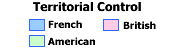 |
Territorial Control |
Forts | |
Marshlands | |
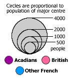 |
Major centres, 1750 |
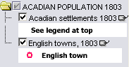
English towns, 1803 |
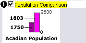 |
Population comparison bar graphs show the population of generalized areas in 1750 and 1803. The area relating to the bar graphs is labeled below the graphs (eg. New Brunswick Coast). See Active tools below to learn how to get the exact numbers represented by these bar graphs. |
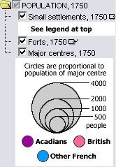 |
The two folders (POPULATION 1750, ACADIAN POPULATION 1803) each represent separate years. If you click on the check box beside the folder, all of the layers within it will turn on. You can also turn off or on the layers within the folders to see each one individually.
Click on the tag icon |
 |
| Active Layer: Turning on the Population Comparison layer makes it the active layer. You can then use the tools below to get the details behind the bar graphs. | |
Identify: Click on this tool, then click at the base of a bar graph to popup the Area Name. |
|
| Table: Click on this tool and then click or drag on the map to select bar graphs to popup a table comparing the population of the selected areas in 1750 and 1803. |
| Acadians 1750 | Total number of Acadians in the area in 1750. |
| Acadians 1803 | Total number of Acadians in the area in 1803. |
| Area name | General areas of Acadian settlement by which population has been grouped, for comparison of population distribution before and after the deportation experience. |