|
|
||||||
Area units: Data units: |
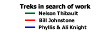 |
Treks in search of work |
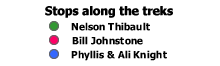 |
Stops along the treks |
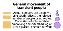 |
General movement of transient people |
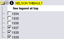 |
Clicking the checkbox beside the folder icon will turn on all six layers associated with Nelson Thibault's trek. Only one trek can be displayed at once. Clicking the checkbox beside NELSON THIBAULT will turn off the BILL JOHNSTONE or PHYLLIS AND ALI KNIGHT layers if they are on. Each layer within this folder represents a year of travel and work along his trek. When checked, each will show the travel routes and stops along his trek for that year. Each layer (or year) can be turned on and off individually. |
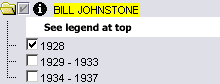 |
Clicking the checkbox beside the folder icon will turn on all three layers associated with Bill Johnstone's trek. Only one trek can be displayed at once. Clicking the checkbox beside BILL JOHNSTONE will turn off the NELSON THIBAULT or PHYLLIS AND ALI KNIGHT layers if they are on. Each layer within this folder represents a timeperiod of travel and work along his trek. When checked, each will show the travel routes and stops along his trek for that timeperiod. Each layer (or timeperiod) can be turned on and off individually. |
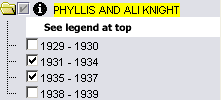 |
Clicking the checkbox beside the folder icon will turn on all four layers associated with Phyllis and Ali Knight's trek. Only one trek can be displayed at once. Clicking the checkbox beside PHYLLIS AND ALI KNIGHT will turn off the NELSON THIBAULT or BILL JOHNSTONE layers if they are on. Each layer within this folder represents a timeperiod of travel and work along their treks. When checked, each will show the travel routes and stops along their trek for that timeperiod. Each layer (or timeperiod) can be turned on and off individually. |
| Zoom in: Zooming in on this map will cause the numbered stops along the treks to turn from numbers into small descriptions of what took place at each stop. | |
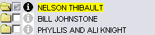 |
Click on the checkbox beside any of the trek folders, to make it the active layer, then use the tools below to get data about this layer. |
Identify: Click on any one of the stops along the trek (coloured circles), to pop-up a window describing the events that took place at every stop along the trek. This is designed to be used when zoomed-out, and the stops are labeled simply with numbers. When zoomed in, the stops become labeled with complete descriptions of the events that took place at that stop (see Map Tips below). |
|
| Table: Click on any one of the stops along the trek, or click and drag across the map to select a group of stops to learn more about the trek. See Table Fields below for a description of the information available. |
| Place | Name of the city or town where the trekker stopped. |
| Story of trek | The details of what happened to the trekker when they stopped in that city or town. |
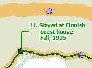 |
Zoom in to have the stories of the treks display right on the map. Zooming in however, will cause the numbers at each stop to be replaced by the story of what happened at that stop (see image at left). |