|
|
||||||
Area units: Data units: |
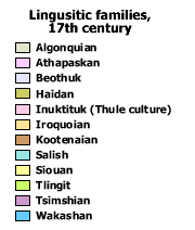 |
Linguistic families, 17th century |
| This layer shows areas occupied by native population as classified by linguistic families.
These are approximate boundaries and transition zones may have occurred. Use the labels button ( |
|
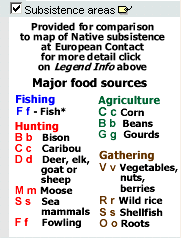 |
Another map in this chapter, Native Subsistence at European Contact, Ethnohistoric Data,
depicts areas of subsistence classified by dominant and secondary activities and food sources. The boundaries and labels
( |
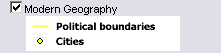 |
Checkbox controls visibility of modern geography (current provincial and territorial boundaries, as well as selected cities), and is available for reference. |
The active layer in this map is Linguistic families. Use the identify tool below to get data about the linguistic families in this layer. |
|
 |
Identify: The Identify and Table tools may be used to identify Linguistic families, but no other tabular data is available from this map. |
| Linguistic families information is based on secondary sources with some adjustments in distribution indicated by primary sources. |