|
|
||||||
Area units: Data units: |
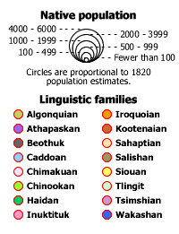 |
Native population and linguistic families
|
 |
Seasonal movement arrows |
 |
Native economies |
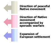 |
Long-term movement patterns |
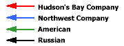 |
Maritime commerce, 1820 |
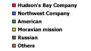 |
Trading posts and missions, 1820 |
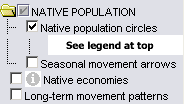 |
The NATIVE POPULATION folder contains layers showing native population circles, and seasonal movement arrows. The layers can be viewed individually or together. |
|
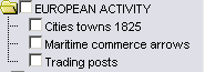
This folder contains layers showing aspects of European activity in Canada ca 1820, which affected native activities. |
|
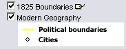
These layers show political reference information for boundaries in 1825, and boundaries and cities today. The layers can be viewed individually or together. |
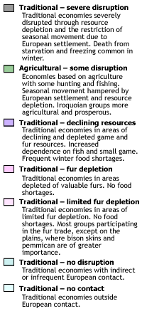
| This is the active layer. Use the tools below to get data about the native economic zones in this layer. | |
Identify: Click on the Identify tool, then click on the map on one of the economic zones, to pop up a page showing the description for that zone. |
|
Table: Click on the Table tool, then click or drag a rectangle on the map across one or more economic zones, to select features and pop up a table showing information about them. See Table Fields below. |
| Economic type | One of 8 economic zones characteristic of Native Canada ca 1820. |
| Description | Description of disruption of traditional economies as a result of European influence. |
|
Much of the HBC census material is complete for men, women, and children. In cases where only men were counted, a total population was extrapolated using population ratios derived from nearby groups living in a similar environment with a similar economy. Where later censuses had to be used for Native groups who were affected by epidemic diseases after 1821 (eg, Tlingit), the population totals were adjusted upward by one-third. Data for some of the Plains groups (eg, Blackfoot, Assiniboine) were originally given in numbers of tents. These were converted to population numbers on the basis of eight people per tent, as suggested by contemporary observers. It is impossible to determine how accurate the early censuses and estimates were. Early 19th-century populations in the Cordillera are particularly difficult to establish. There were 11 HBC censuses of various areas, some overlapping, none surviving in original form. The copies that do survive, made in 1878 by one of H.H. Bancroft's researchers, usually do not indicate the date of the enumeration. Given these limitations it is no easy matter to resolve the contradictions arising between different, overlapping estimates. For example, there are five separate censuses of some or all of the Southern Kwakiutl but only one includes a date (summer 1838), and none indicates who was responsible for the compilation. Wilson Duff used this material and his own large knowledge of Native British Columbia to prepare the population map in The Indian History of British Columbia. We have been over the same ground, correcting some mistakes on Duff's map while following its general patterns. A comprehensive analysis of these censuses and other estimates of early-contact Native populations in the northern Cordillera remains to be done. |