|
|
||||||
Area units:
Circles and pies represent population in cities, or in the province excluding these cities. Data units:
Province/city circles and pie graphs show total population,
and absolute numbers by main ethnic origins.
|
.gif) |
Province/city circles and pie graphs: Provincial and city data is represented by proportional circles or pie graphs. They appear gray when zoomed out, but zoomed in they subdivide into proportional pie graphs, with the slices representing the ethnic breakdown within that province or city. The pies displayed represent all ethnic groups greater than 1% of the population. All other ethnic groups are represented as "All others". The province data is exclusive of the city data; for example, the Ontario circle or pie graph (and associated table) does not include data from Toronto or Ottawa, as these cities have their own circles/pies. |
.gif) |
Number of persons: |
.gif) |
Ethnic Origin: The ethnic origin colour scheme applies to both the population pie graphs, and the census division colouration. Only groups accounting for more than 1% of the total population of a census division are explicitly represented. Ethnic origin refers to the ethnic group to which a person belongs, and does not necessarily indicate place of birth or place of residence. |
| Checkbox controls the visibility of the proportional circles or pie graphs representing the province/city data. | |
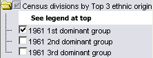 |
Checkboxes control the visibility of census divisions coloured to represent the 3 most dominant groups by ethnic origin. Layers represent 1st, 2nd and 3rd most populous groups. When any of the top 3 groups is less than 1% of the population, no colour is shown (not considered a dominant group). Within each Census division, only the settled area or ecumene (generalized area of continuous settlement) is coloured to show data. |
 |
Modern Geography ( current provincial and territorial boundaries, as well as selected cities) is available for reference. |
| Zoom in: Provincial and city data is represented by proportional circles or pie graphs. They appear solid gray at the initial view. Zoom in to change circles to pie graphs, with the slices representing the ethnic breakdown within that province or city. | |
| Click on the |
|
Identify: Click anywhere in a province, or at the centre of a city pie graph, to popup the name of that province or city. |
|
| Table: Click or drag a rectangle to select any of the provinces or cities. A table pops up showing: the name of the province or city, the numbers of people of various ethnic origins, and the total number of people. See Table Fields below. | |
| Click on the |
|
Identify: Click on a census division to display the name of that census division. |
|
| Table: Click or drag rectangle to select census divisions. A table pops up showing the numbers of people within the 3 most populous ethnic origins. See Table Fields below. |
| Province or city | Name of City or Province (excluding selected cities listed in that province which have separate symbols) |
| British, French, German, Dutch Scandinavian, Italian, Jewish Native peoples, Asian, All others | Absolute numbers of people of this ethnic origin in that city or province |
| TOTAL | Total number of people in that city or province |
| CD Name | Name of Census division |
| Total pop'n | Total population of Census division |
| 1st Group, 1st Pop'n, 1st Percent | Most populous ethnic group in this Census division: Name of group; Absolute number; Percentage of total population of CD |
| 2nd Group, 2nd Pop'n, 2nd Percent | Second most populous ethnic group in this Census division: Name of group; Absolute number; Percentage of total population of CD |
| 3rd Group, 3rd Pop'n, 3rd Percent | Third most populous ethnic group in this Census division: Name of group; Absolute number; Percentage of total population of CD. Where there are only two ethnic origins greater than 1% of the total in the census division, the 3rd group is listed as "none". |
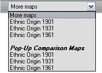 |
Pop-up Comparison Maps |
| Since the 1901 and 1935 censuses of Newfoundland and Labrador gave only place of birth and not ethnic origin, Newfoundland is not included in 1901 and 1931. Graphs of cities specify ethnic groups of 0.4% or larger; graphs of provinces specify groups of 1.0% or more except 'other' which may be less than 1.0%. |