|
|
||||||
Area units: Data units: |
.gif) |
Students attending |
.gif) |
Percentage of total population |
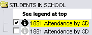 |
Checkboxes control the visibility of school attendance by census division. Clicking on 1851 turns off 1881, and vice versa, and whichever layer within this folder is on is the active layer (see explanation in Active Tools below). |
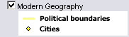 |
Checkbox controls visibility of Modern Geography (current provincial and territorial boundaries, as well as selected cities), and is available for reference. |
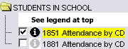 |
Active Layer: Clicking on 1851 Attendance by CD or 1881 Attendance by CD will make the proportional circles for that year visible on the map, and also make that layer active. |
Identify: Click anywhere in a grouped census division to display the name of that grouped census division. |
|
| Table: Click or drag a rectangle to select any of the grouped census division. A table pops up showing information by grouped census division. See Table Fields below. |
| Grouped census division | Census divisions which have been grouped in order to create comparability between 1851, and 1881. |
| Total population | Total population of the grouped census division (not just school-aged children). |
| Students attending | Total number of students attending school. |
| % of total population | Percent of total population attending school. |
| Unless otherwise indicated, data for all maps and graphs were taken from the annual reports of the various chief superintendents and ministers of education for the several British North American colonies to 1867, and for the provinces of Canada after that date. Where data were reported by municipal districts other than counties, these were amalgamated or incorporated into counties with the assistance of the Gazetteer of Canada. |