|
|
||||||
 |
|
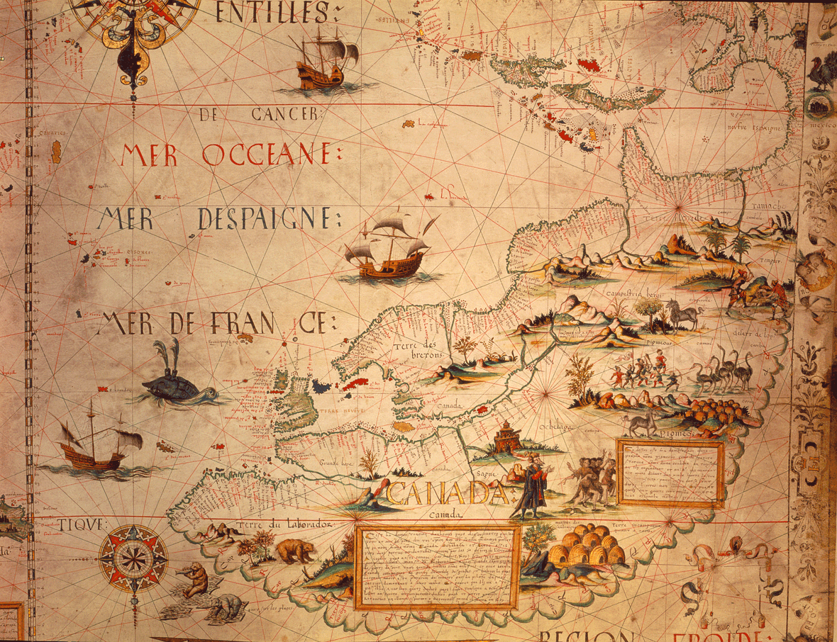
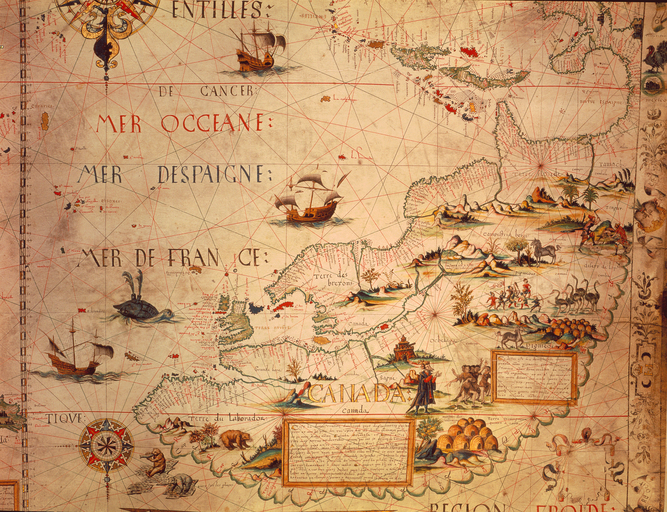
Desceliers map, 1550 (portion) |
|
The Cartier-Roberval voyages (pl 33) greatly enlarged European knowledge of northeastern North America, and enabled cartographers to represent the complex shoreline of the Gulf of St Lawrence with some accuracy. This map by Pierre Desceliers, a cartographer-artist working near Dieppe, illustrates the great expansion of geographical understanding since pre-Cartier days. The delightful illustrations are largely fanciful. |
|
Map in High Resolution
Desceliers Full Original |
|
Original map: A portolan chart drawn by Pierre Desceliers in 1546 Source: ĀLibrary and Archives Canada/NMC 44736 |
|