|
|
||||||
 |
|
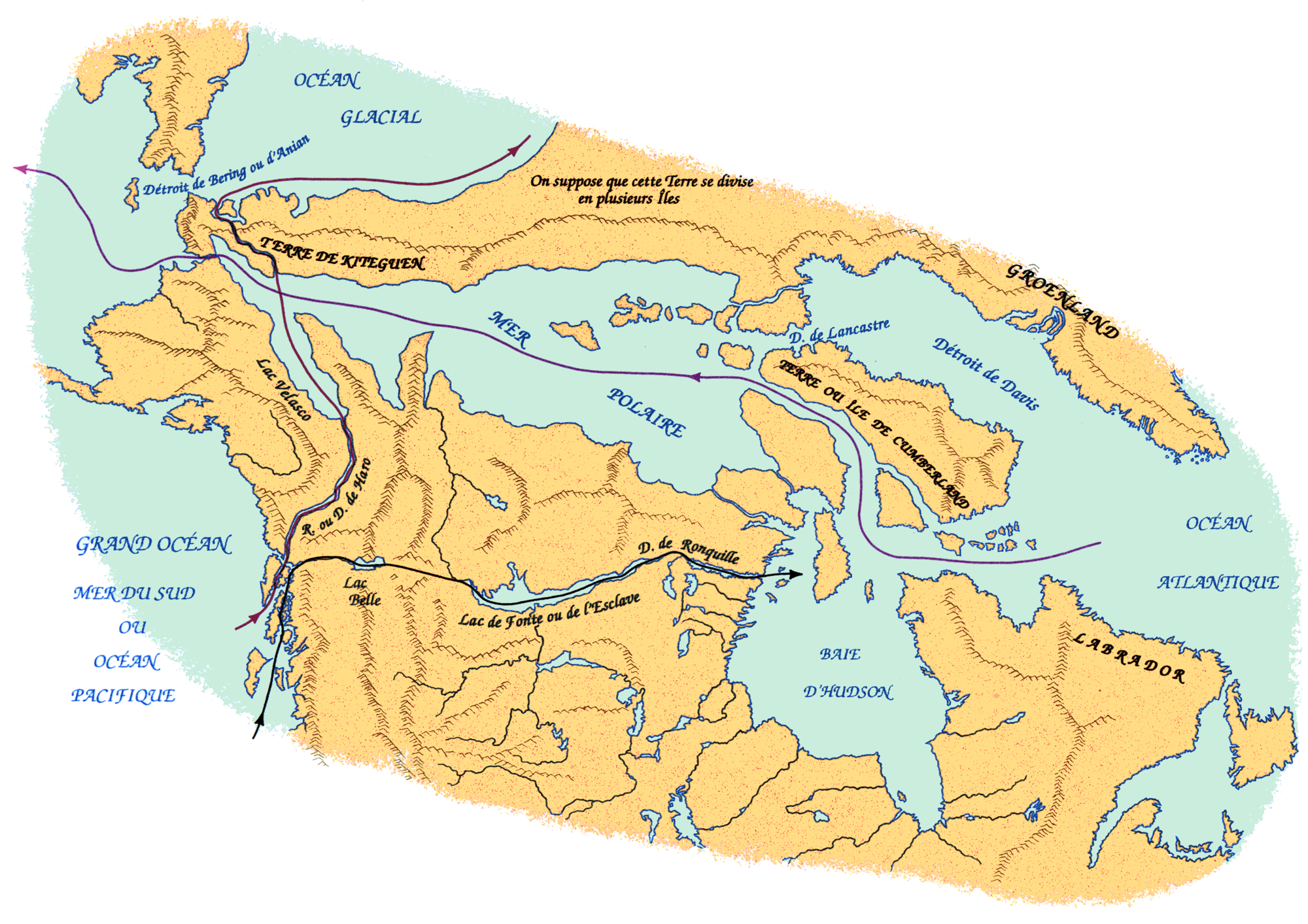
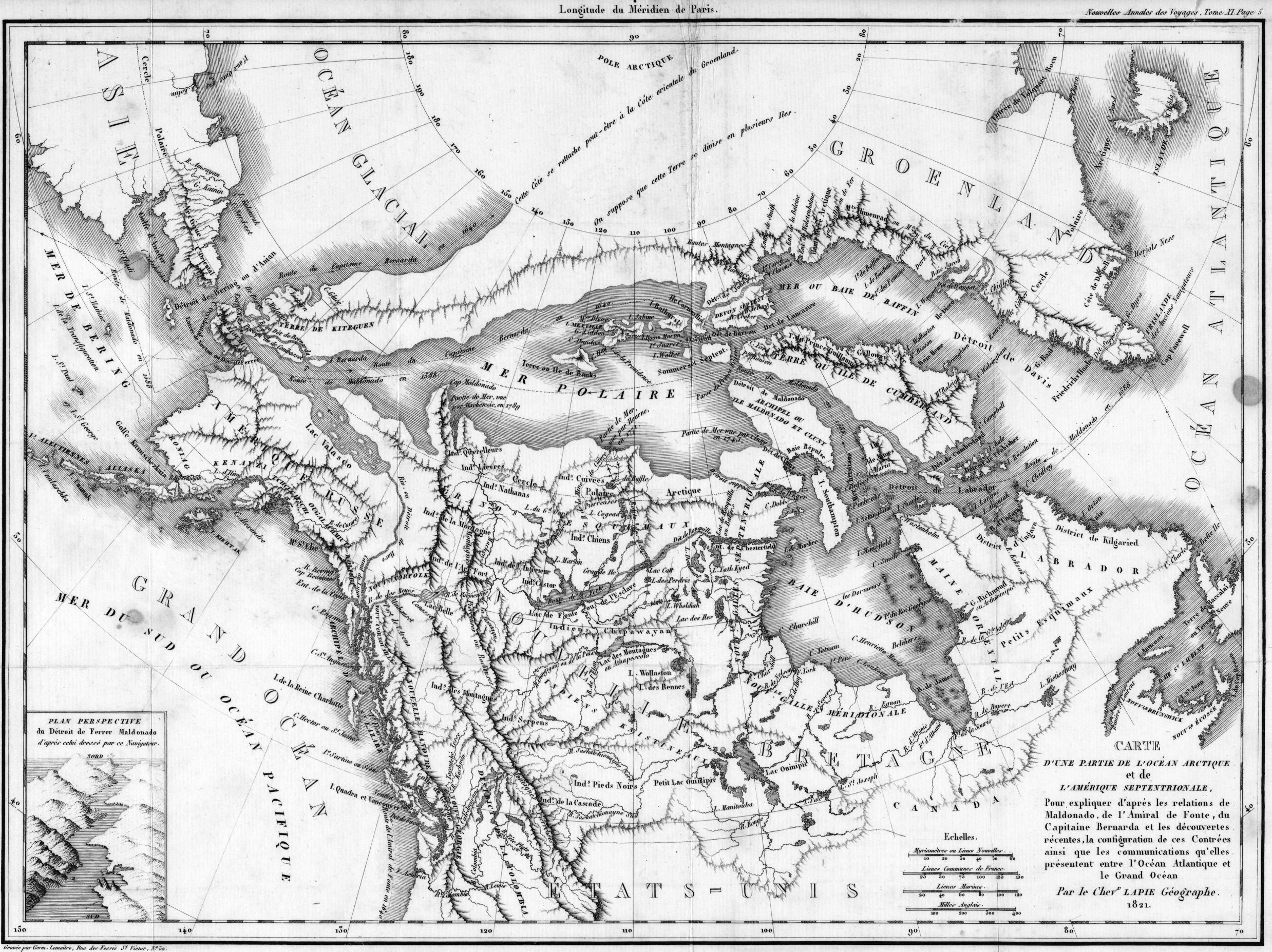
Lapie map, 1821 |
|
An intriguing part of the cartographic record were attempts, of which this is one example, to merge known features with supposed straits and hypothetical routes of early adventurers. |
|
Original map: Carte d'une partie de l'ocean Arctique et de l'Amerique septentrionale. Chevr. Lapie
. 1821
Source: ĀLibrary and Archives Canada/NMC 9845 |
|