|
|
||||||
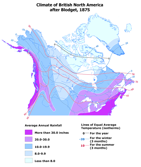 |
The composite temperature and precipitation map, published in 1875, is based on many maps prepared by the American Loren Blodget. Blodget's maps were the first to use isotherms and isohyets to illustrate climatic patterns for annual, winter, and summer conditions for Canada as a whole. |
Maps in High Resolution (.gif)
Blodget_1875_high.gif |