|
|
||||||
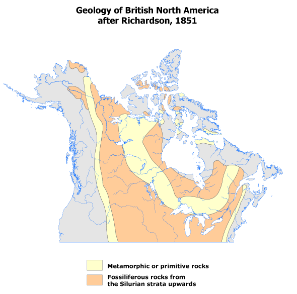 |
The first geological map of a large part of Canada was prepared by Sir John Richardson in 1851 to accompany his book on his search for the Franklin expedition. The map, based on observations made during his earlier expeditions in the western interior and the north, commencing in 1819, includes two geological units, 'Metamorphic or Primitive Rocks' and 'Fossiliferous Rocks from the Silurian strata upwards,' depicting for the first time the boundaries of the Canadian Shield. |
Maps in High Resolution (.gif)
Richardson_1851_high.gif |