|
|
||||||
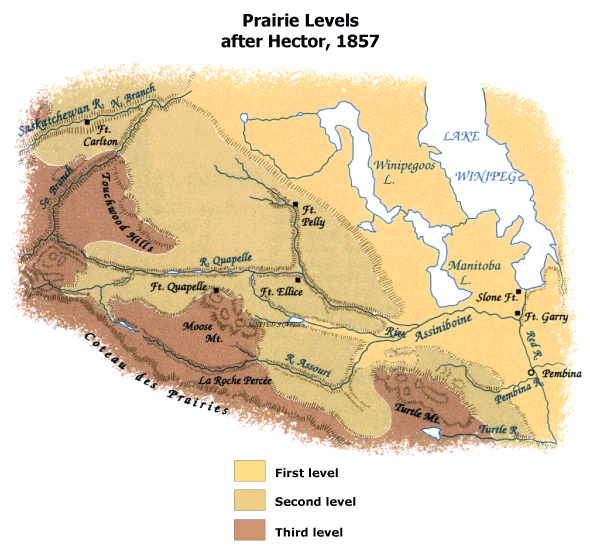 |
In 1857 James Hector, a geologist with the Palliser expedition to the Canadian plains, examined, described, and mapped three boldly marked levels, the first application to the western interior of the geomorphic terms, first, second, and third prairie levels. |
Maps in High Resolution (.gif)
Hector_1857_High.gif |