|
 |
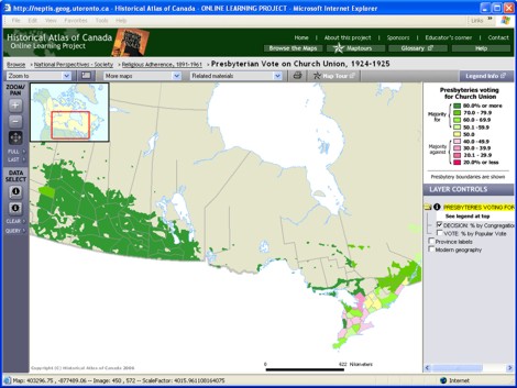
Try This:
- Use the Zoom in tool on the map, to zoom in to the Prairies.
- On the DATA SELECT toolbar, click on the Table tool and then
click and drag a rectangle on the map to include several of the units
("presbyteries.")
|
|
 |
Notice ...
- The data table displays the vote for church union both by
congregations and by individuals, presbytery by presbytery.
- The limits of the presbyteries you selected are individually highlighted.
(You may have to drag the table aside to see this.)
-
The proportion of congregations in each presbytery that voted in favour of
Union in 1925 was almost always greater – and frequently a great deal greater –
than the proportion of the vote when reported by individual ballots (the “popular vote”).
|
|
 |
Consider!
- The strength and homogeneity among Prairie voters was not
as strong as the map would suggest.
- Ontario appeared to have been consistently heterogeneous,
not only between presbyteries but also within them.
- The manner in which votes are recorded in elections can
yield highly discordant results.
|
|
| |
These are just a few of the questions that
these maps and data can address
If you have ideas for other questions, please use our
Feedback page to send them in,
and they may be posted on the website in the future.
|