Maptour Page 4
Maptour: The Boundaries of Canada, 1670-2001
Maptour: The Boundaries of Canada
Print
Close
< Previous
1
2
3
4
5
6
7
8
Next >
America’s Revolutionary New Nation
Click to enlarge
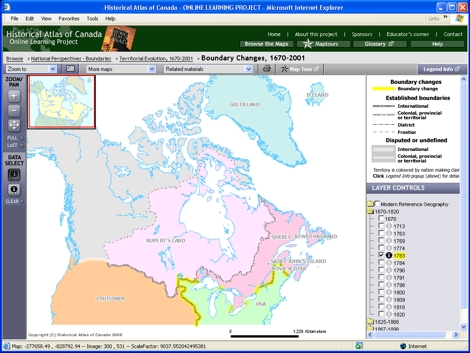
Map: Boundary Changes, 1670-2001
Try This:
Keep open
the interactive map "Boundary Changes, 1670-2001."
Under LAYER CONTROLS,
turn on
the checkbox for "1774"; then
turn on
"1783."
Click back and forth
, noting the substantial changes that occur on the map.
Notice ...
The Canada - United States border through the Great Lakes appears for the first time.
Consider!
In 1783 the United States, a sovereign nation, was poised to indulge its own territorial - some would say imperial - ambitions both west and north.
< Previous
Next >