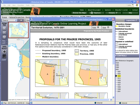
Static map: Proposals for the Prairie Provinces, 1905
Try This:
Click on the "Related Materials" drop-down menu
and select Static maps - "Proposals for the Prairie Provinces, 1905."
Notice ...
Geometry prevails. All proposed boundaries in the prairies are based
upon the global gridwork of lines of latitude and longitude.
Consider!
Politicians charged with dividing up the prairies had no concept
of (nor any apparent interest in) the physical geography of the region;
they took the prairies to be a flat expanse of undifferentiated space.