Maptour Page 8
Maptour: The Boundaries of Canada, 1670-2001
Newfoundland Joins Confederation


Click to enlarge

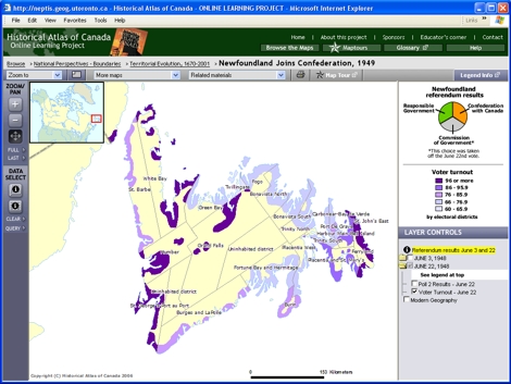
Map: Newfoundland Joins Confederation, 1949

Try This:

  • Click on the "More maps" drop-down menu and open the interactive map "Newfoundland Joins Confederation, 1949."
  • Under LAYER CONTROLS, close the folder for "JUNE 3, 1948" and open "JUNE 22, 1948."
  • Turn off the checkbox for "Poll 2 Results" to see the underlying pattern of "Voter turnout". Click back and forth between the two views to compare them.

Notice ...

  • The Newfoundland settled area is focused on the sea.
  • Voters in the St. John's region were far less inclined to join Canada than were Newfoundlanders elsewhere.

Consider!

  • Outport Newfoundlanders saw Confederation with Canada as an opportunity to trade impoverishment for financial security.

Try This:

  • Click on the "Related materials" drop-down menu and select Graphs - "Newfoundland Referendum Results."
  • Click on the file under "Data Files (.xls)" to see the numbers upon which these graphs are based.

   These are just a few of the questions that these maps and data can address.
If you have ideas for other questions, please use our Feedback page to send them in, and they may be posted on the website in the future.