Close the Slideshow window, to return to
the interactive map "Boundary Changes, 1670-2001."
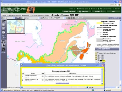
Under LAYER CONTROLS, close the folder for "1670-1820",
and open the folder for "1867-1898".
Turn on the checkbox for "1867."
Notice ...
Ontario and Quebec were far smaller in 1867
than they are in the 21st century.
Try This:
On the ZOOM/PAN toolbar, click on
the Zoom in button and use it on the map to zoom
in to the Ontario-Québec area.
On the DATA SELECT toolbar, click on the Table tool
and then drag a rectangle around the Ontario-Québec-Rupert's
Land boundaries on the map to select them and pop up their data table.
Notice ...
The table entries explain the constitutional, boundary and name changes
occurring in 1867.
Consider!
One way for the British to resist Manifest Destiny is to
grant Canada status as a Dominion, uniting the most densely
inhabited and most productive colonies of British North America.