|
|
||||||
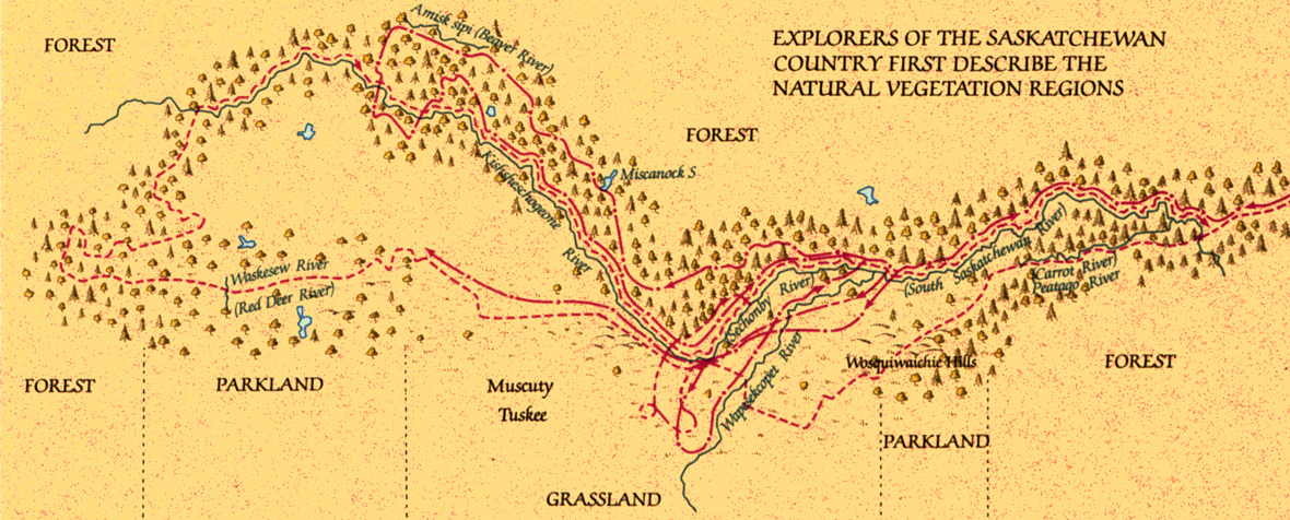 |
Saskatchewan country map |
This map shows how HBC traders understood the Saskatchewan country in the early 1770s, by which time many of them had penetrated the region by canoe or on foot. Some (notably Kelsey, Henday, Pink, and Cocking) kept daily journals and made regular environmental notations. Henday, who in 1754-5 was perhaps the first European trader to traverse the regions between northern Manitoba and the foothills of the Rocky Mountains, lived with Indians and relied on Indian guides; he left the most comprehensive survey. |
Maps in High Resolution (.gif)
Saskatchewan_High.gif |