|
|
||||||
 |
|
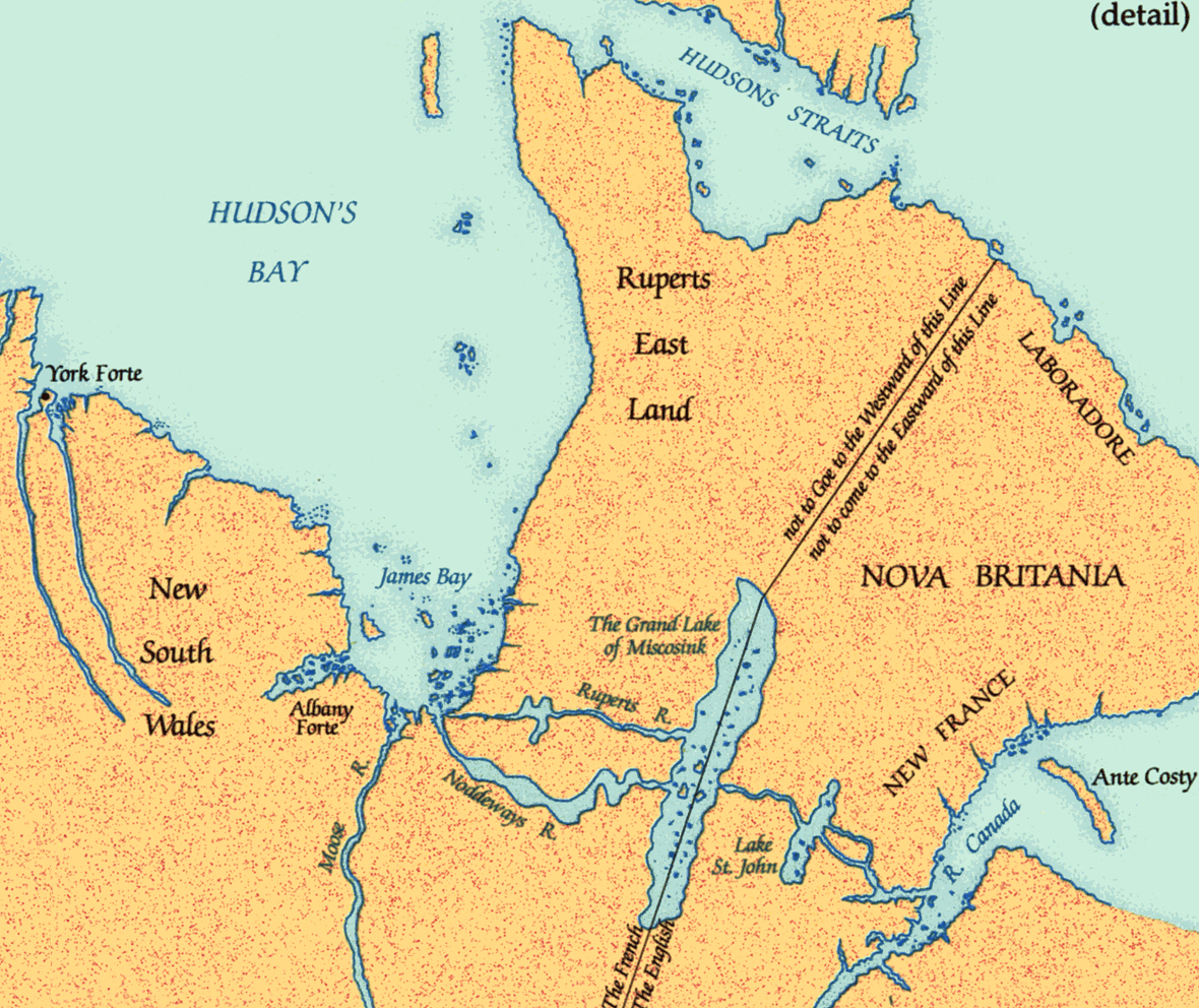
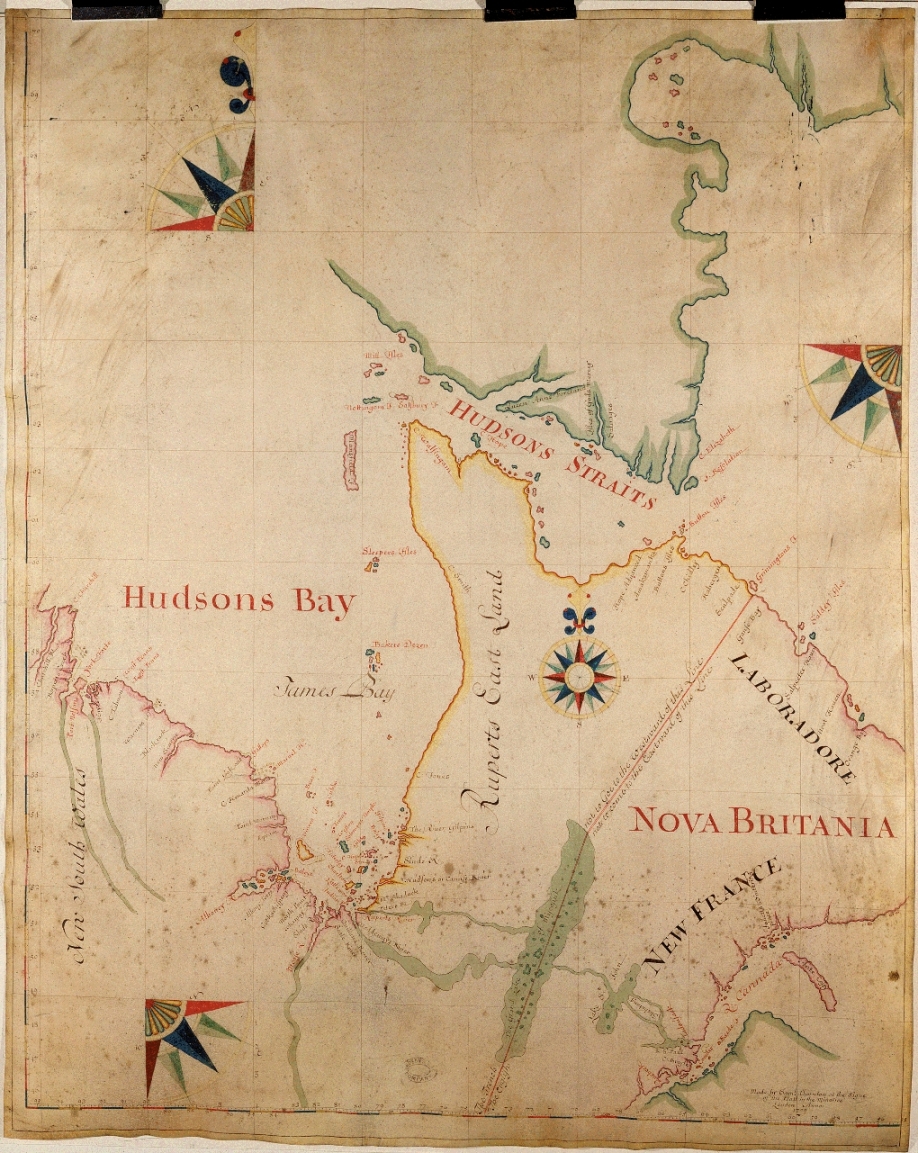
Thornton map, 1709 |
|
Samuel Thornton, a London chartmaker, drew this map for the HBC to illustrate the sea route to the company's forts and the purported extent of the company's territories. The boundary running from an enlarged Lake Mistassini through unexplored country was proposed by the company but resolutely rejected by the French. In 1709 there had been no detailed exploration of the Eastmain north of the Big River. |
|
Original map courtesy of Hudson's Bay Company Archives, Archives of
Manitoba. HBCA G.2/1 |
|