|
 |
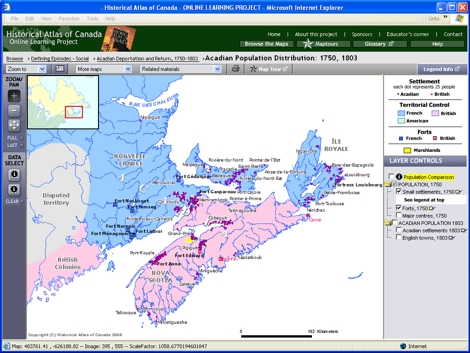
Try This:
-
Under LAYER CONTROLS, turn on the checkboxes for "ACADIAN POPULATION, 1803."
- Click on the tag icons
 following "Acadian settlements, 1803" and "English towns, 1803" to turn on their labels. following "Acadian settlements, 1803" and "English towns, 1803" to turn on their labels.
|
|
 |
Notice ...
- The label "Acadia," used in 1750, is gone in 1803.
- The map is entirely “British pink.”
- The two large islands and various water bodies bear English names. (The Latin, "Nova Scotia," survives!)
- French names persist in the villages and outlying areas.
|
|
 |
Consider!
- It was French people who gave place names to this region, previously occupied by Native peoples.
- Through its place names, this area demonstrates defiance.
- The ancestors of the Rankins and Natalie McMaster had yet to come to Cape Breton Island.
- Place-naming tells a great deal about society and identity in a region.
|