|
Notice ...
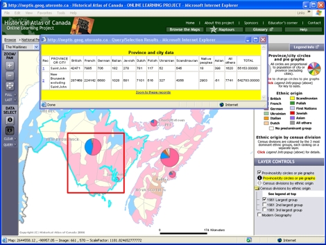
- New Brunswick and Saint John are selected and highlighted on the map,
and a table opens, giving numbers of people by ethnic group for the city
and for the rest of the province.
- The French-British mix in Saint John is not representative of the province as a whole.
|
|
 |
Try This:
- Close the table box, and on the DATA SELECT toolbar click on CLEAR,
unselecting New Brunswick and Saint John and removing the highlighted outline.
|
|
|
Notice ...
- Looking at the pie charts,
the ethnic mix in Halifax is very similar to the overall pattern for Nova Scotia.
|
|
 |
Consider!
- New Brunswick is Canada’s only officially bilingual province.
|